

Europe: 500hPa Geopotential Height – Cloud Tops
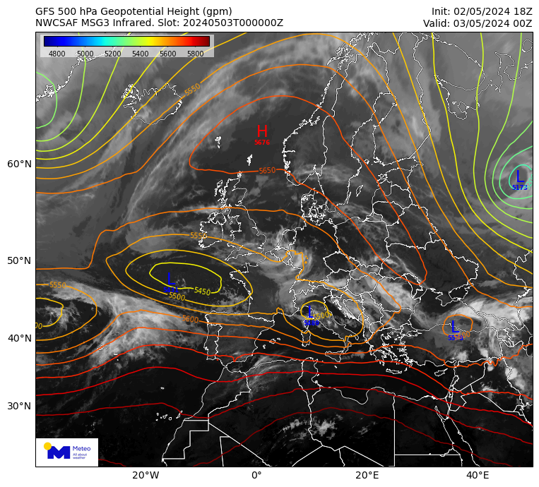
300hPa Geopotential height – Cloud Tops is a product computed by the National Observatory of Athens. It presents the cloud tops, provided by the NWC SAF v2021, and the geopotential height at the 500 hPa level, which is provided by the GFS global numerical weather prediction model. The product is provided every 15 minutes, at the time of the satellite image.